
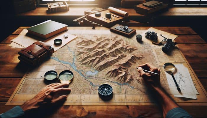
Mastering the Essential Aspects of Map Reading
Decoding Map Symbols for Effective Navigation

Map Reading Skills: Effectively reading a map relies heavily on your ability to decode map symbols. These symbols represent a variety of both natural and artificial features, providing vital information essential for navigation and exploration. A thorough understanding of these symbols not only facilitates practical navigation but also fosters a deeper connection with the surrounding landscape, significantly enhancing your overall outdoor experience and appreciation of geography.
Among the most common map symbols are:
- Blue Lines: These signify water bodies, such as rivers and lakes.
- Green Areas: Indicate forested regions or parks.
- Black Dots: Represent urban areas or significant landmarks, such as schools.
- Brown Lines: Depict contour lines that illustrate elevation changes.
- Red Lines: Typically indicate main roads or highways.
- Yellow Areas: Show open land, fields, or agricultural regions.
- Triangles: Mark hilltops or summits.
- Broken Lines: Represent trails or paths.
Recognising these symbols equips you with the necessary tools for efficient map navigation, making it easier to identify your surroundings and effectively plan your route.
How to Interpret Contour Lines for Terrain Navigation
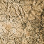
Understanding contour lines is crucial for interpreting a topographic map, as they illustrate changes in elevation and the overall shape of the terrain. These lines indicate the steepness or gentleness of slopes, which is vital for outdoor activities like hiking, climbing, or even urban planning. Being adept at interpreting these lines can significantly enhance your ability to navigate various landscapes, ensuring you’re well-prepared for the challenges that lie ahead.
To distinguish between gentle and steep slopes, pay attention to the spacing of contour lines. When contour lines are closely spaced, they indicate a steep slope, suggesting a sharp incline or decline. Conversely, when the lines are spaced further apart, they represent a gentle slope. For instance, while navigating a mountainous trail, recognising these patterns can help you assess the difficulty of the ascent, allowing for appropriate preparation. Moreover, understanding contour intervals, or the vertical distance between adjacent lines, provides critical insights into elevation changes, greatly aiding in route planning and assessing safety.
The Significance of Understanding Map Scale
Map scale is a fundamental concept that determines how distances on the map relate to actual distances on the ground. A solid grasp of scale is essential for effective navigation, ensuring that your estimated distances remain accurate and reliable. Various types of map scales exist, each serving distinct purposes and contexts.
Typically, there are three primary types of scales: graphic, verbal, and ratio. A graphic scale features a line marked with distances that can be measured directly against the map, eliminating the need for calculations. A verbal scale describes the relationship in words, such as “1 inch equals 1 mile.” Lastly, a ratio scale, like 1:50,000, indicates that one unit on the map corresponds to 50,000 of the same units in reality. Having a firm understanding of these scale types guarantees that you can accurately gauge distances while traversing varying terrains, whether navigating through dense forests, sprawling urban environments, or rugged mountains.
Expert Strategies for Enhancing Map Reading Skills

Techniques for Accurate Map Orientation
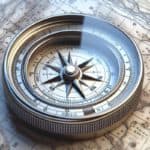
Accurate orientation is paramount for effective navigation, particularly in unfamiliar environments. Mastering the art of orienting a map involves aligning it with the surrounding landscape, a skill that can be honed using a compass. This technique not only enhances your geographical awareness but also builds confidence during outdoor expeditions, making navigation a more enjoyable experience.
To orient a map correctly, first hold it flat and rotate it until the north on the map aligns with the magnetic north indicated by your compass. For example, while hiking on the Appalachian Trail, this technique ensures your map aligns with the natural features around you, allowing for effective route planning. By using a compass in conjunction with your map, you can accurately track your progress, assess landmarks, and make informed decisions regarding your path. Regular practice of this technique in varied environments will further enhance your skills and ensure you can navigate confidently, regardless of your location.
What Are the Best Practices for Effective Map Reading?
Implementing best practices in map reading ensures that navigators can interpret maps efficiently and accurately, leading to safer and more enjoyable outdoor experiences. Enhancing your map-reading skills can be achieved through structured practice and strategic training, enabling you to improve your navigation capabilities significantly.
To elevate your map-reading skills, consider these actionable strategies:
- Practice Regularly: Dedicate time to reading different types of maps in various environments to build familiarity.
- Join Outdoor Groups: Engage with experienced navigators who can provide guidance, tips, and share their insights.
- Utilize online resources: access tutorials and courses that focus on map-reading techniques and skills enhancement.
- Set Navigation Challenges: Use maps to navigate new trails or urban areas, gradually increasing the difficulty level.
- Simulate Real-World Scenarios: Develop exercises that replicate emergencies, requiring proficient map-reading skills.
- Record Your Progress: Keep a journal of your navigation experiences to track your improvements and identify areas that need focus.
By adopting these practices, you can elevate your map-reading proficiency and feel more secure navigating diverse landscapes, enriching your outdoor adventures.
Advanced Strategies for Proficient Map Reading
Once you have mastered the fundamentals of map reading, employing advanced strategies can significantly bolster your skills, enabling you to navigate complex terrains confidently. Mastering these techniques prepares you to handle various environments, whether you are hiking in the Andes or traversing the Sahara Desert.
One effective advanced strategy involves multitasking between different types of maps, such as topographic and thematic maps. For instance, using a topographic map alongside a thematic map that highlights flora and fauna can deepen your understanding of the environment. This approach allows you to connect the physical features of the terrain with the ecosystems you encounter. Additionally, leveraging technology, such as augmented reality apps, can provide real-time overlays of information on your surroundings, offering a contemporary advantage in navigation.
Another effective strategy is to develop mental maps, which involve visualising the landscape based on your map reading. This technique reinforces your navigational skills, especially when you find yourself away from digital devices or traditional maps. By consistently applying these advanced strategies, you can refine your map-reading skills and develop a more comprehensive understanding of your surroundings.
Common Map Reading Errors and How to Prevent Them
Identifying common mistakes in map reading can be transformative for novice navigators, helping to prevent potential mishaps and enhancing the overall experience. Awareness of these pitfalls allows you to approach map reading with greater confidence and accuracy.
Frequent errors in map reading include:
- Ignoring Scale: Failing to consider the map scale can result in significant miscalculations of distance.
- Misinterpreting Symbols: Confusion over map symbols can result in navigating towards incorrect landmarks.
- Neglecting Contour Lines: Failing to account for elevation changes can pose significant safety risks, particularly in mountainous areas.
- Relying Solely on GPS: Over-dependence on digital navigation can erode essential map-reading skills.
- Not Orienting the Map: Starting with a non-oriented map can lead to disorientation in the field.
- Skipping Practice: Infrequent practice can hinder skill development and diminish confidence.
- Failing to Account for Environmental Changes: Failing to update your route based on recent changes in the terrain can lead to navigational errors.
To avoid these mistakes, always double-check your scale, practice regularly, and seek advice and feedback from fellow navigators. Incorporating these strategies into your navigational routine will enhance your map-reading skills and overall outdoor experience.
Essential Tools and Technologies for Effective Map Reading
Traditional Tools for Navigational Accuracy
Despite the rise of digital navigation tools, traditional map-reading tools such as compasses and protractors remain indispensable in many situations. Understanding their advantages over digital alternatives can significantly enhance your navigation skills and ensure you’re well-prepared for any circumstance.
Traditional tools offer reliability and durability that electronic devices may lack. For instance, compasses function independently of batteries and are unaffected by electronic interference, making them essential in remote areas where GPS signals may be unreliable or nonexistent. Additionally, they encourage a deeper connection with the landscape, as users must actively engage with the physical map and understand its features, rather than relying on digital cues. Furthermore, learning to use traditional tools cultivates essential skills and fosters self-reliance, which can be crucial in emergencies or off-grid situations.
Incorporating traditional tools into your navigational practices allows for a well-rounded skill set, ensuring you are equipped to handle various challenges effectively. Having both traditional and digital tools at your disposal can create a robust navigation strategy, enabling you to tackle any environment with confidence.
Innovations in Digital Mapping Applications
Digital mapping applications have revolutionised the way we interact with maps, providing advanced tools that enhance navigation and exploration. These applications offer dynamic features that can complement traditional map reading techniques, resulting in a more integrated approach to navigation.
One significant advantage of digital mapping apps is their ability to provide real-time updates and detailed information about your surroundings. Many applications, such as Google Maps or AllTrails, feature user-generated content, showcasing current trail conditions, hazards, and points of interest. This interactivity allows you to adjust your plans based on crowd-sourced data, making your navigation experience more efficient and informed.
To effectively integrate digital maps with traditional techniques, consider using your smartphone’s GPS to complement your compass. For example, while hiking in a national park, use the app to track your progress and periodically check your compass to maintain your orientation. This hybrid approach ensures that you remain proficient in traditional navigation while benefiting from the convenience and features of modern technology.
Integrating GPS with Traditional Maps for Enhanced Navigation
The advent of GPS technology has dramatically improved navigation by providing real-time location data, significantly enhancing the effectiveness of traditional maps. Understanding how to utilise GPS in conjunction with maps can create a powerful navigational toolkit.
When using GPS alongside maps, several key considerations must be taken into account. First, ensure your GPS device is fully charged and functional before heading into areas where power sources are scarce. Moreover, familiarise yourself with the terrain and features depicted on both the GPS and the map to avoid confusion in dense areas. For instance, while trekking through thick forests, relying solely on GPS could lead to disorientation in an environment where landmarks are obscured.
Furthermore, it’s wise to frequently cross-reference your GPS location with the map to ensure accuracy, particularly in unfamiliar areas. By regularly verifying your position, you can avoid common pitfalls associated with solely relying on technology. This balanced approach to navigation will promote a deeper understanding of your environment and build greater confidence in your mmap-readingskills.
How Can Enhanced Map Reading Skills Improve Navigation?
Boosting Your Directional Awareness through Map Reading
Map-reading skills play a pivotal role in enhancing your sense of direction, which is crucial for navigating unfamiliar areas. By developing these skills, you can significantly boost your confidence and ability to explore new territories, whether you are wandering through the bustling streets of Tokyo or the vast landscapes of Patagonia.
When you engage in map reading, you learn to understand the spatial relationships between various landmarks and features. This cognitive process enhances your ability to visualise your surroundings, making it easier to orient yourself and determine the best route to your destination. For instance, if you are hiking in the Canadian Rockies, the ability to identify peaks, valleys, and water sources on a map can drastically improve your navigation experience. You will be able to utilise both the map and your surroundings to gauge direction, distances, and potential hazards.
Moreover, practicing map reading in diverse environments equips you with a broader understanding of geography, which can be beneficial for everyday navigation and travel. Whether you’re traversing urban settings or natural landscapes, being adept at reading maps fosters a keen sense of direction and spatial awareness, which is invaluable for any adventurer.
Strategies for Planning Efficient Routes
Planning efficient routes is a critical aspect of effective navigation, enabling you to reach your destination swiftly and safely. Developing this skill through map reading can lead to significant time savings and a more enjoyable exploration experience.
To plan the best routes using maps, begin by identifying your destination and assessing the key features depicted on your map. Look for trails, roads, or paths that lead directly to your target, considering elevation changes indicated by contour lines. For instance, while planning a hike through the Swiss Alps, identifying the most accessible trails that avoid steep inclines can lead to a more enjoyable experience.
Utilising landmarks as reference points during your route planning can also prove beneficial. By marking important features such as rivers, peaks, or towns on your map, you can create a mental checklist for your journey. Additionally, consider factors such as weather conditions, terrain, and potential hazards when planning your route, ensuring you choose the safest path. By honing your route-planning skills, you can navigate with confidence, maximising your outdoor experiences.
Essential Emergency Navigation Techniques
In emergencies, possessing strong map-reading skills can be vital for survival. Knowing how to navigate effectively when the stakes are high can be the difference between safety and danger. Developing these essential map-reading techniques ensures you are prepared to handle unexpected circumstances with confidence.
One critical technique involves understanding how to identify and use landmarks for navigation. In emergencies, natural features such as rivers, mountains, and valleys can serve as reliable reference points for navigation. For example, if you find yourself lost in a dense forest during a hiking trip and your GPS fails, recognizing nearby hills or water sources on your map can guide you back to safety.
Another important skill is the ability to estimate distances and determine your location using contour lines and map scales. In urgent situations, knowing how far you need to travel to reach safety can help you prioritise your actions. Additionally, practicing triangulation —a method that uses two known points to determine your position —can enhance your navigational accuracy during emergencies.
By mastering these emergency navigation techniques, you will feel more at ease and prepared for any unforeseen challenges while exploring various environments.
Utilising Topographical Features for Enhanced Navigation
Understanding topographical maps is integral to enhancing navigation, as they provide detailed insights into the physical features of the landscape. By utilising these maps effectively, you can identify landmarks, elevation changes, and terrain characteristics, leading to more accurate navigation.
Topographical features such as contour lines, ridges, and valleys offer valuable information about the terrain. For instance, when navigating through mountainous areas, being aware of elevation changes can help prepare you for physical challenges and assist in route planning. Knowing where to find water sources, such as rivers or lakes, can also significantly impact your journey, especially in remote areas.
Moreover, utilising topographical features to identify possible hazards, such as cliffs or steep drops, is crucial for your safety. For example, while hiking in the Appalachian Mountains, recognising the contours of the terrain can guide you in avoiding dangerous areas. By integrating knowledge of topographical maps into your navigation practices, you can improve both your safety and overall experience in the great outdoors.
Utilising Map Reading for Recreational Activities
Mastering Map Reading for Hiking Adventures
Accurate map reading is paramount for hikers, as it ensures safe navigation through diverse trails and terrains. By honing your map-reading skills, you can significantly enhance your outdoor experience, enabling you to explore the beauty of nature with confidence.
When embarking on a hike, the first step is to select a reliable map that provides comprehensive details about the trail, including elevation changes, water sources, and significant landmarks. Familiarising yourself with the map symbols and contour lines allows you to assess the difficulty of your chosen trail. For instance, if you are hiking in the Rocky Mountain National Park, understanding the elevation profile can help you prepare for changes in altitude and energy expenditure.
Moreover, practicing map reading during hikes can lead to improved skills over time. Use your map to mark key points of interest, such as scenic vistas or picnic spots, which will enhance your overall enjoyment of the journey. Regular practice in diverse environments will also equip you with the confidence to navigate new trails independently, ensuring that you can maximise your hiking adventures to their fullest.
Orienteering: Combining Map Reading with Physical Activity
Orienteering combines the thrill of navigation with physical activity, making map reading a crucial skill for success in this sport. Participants must use maps and compasses to navigate through various terrains, fostering a strong relationship between navigation and physical fitness.
To excel in orienteering, developing a solid understanding of map symbols and contours is essential. Familiarising yourself with the terrain depicted on the map allows you to make informed decisions about your route. For example, understanding which areas are densely forested or have steep slopes will help determine the best path during a race or challenge.
Additionally, practicing with different types of maps and courses can enhance your skills. Participating in local orienteering events can provide valuable experience and allow you to learn from more seasoned navigators. The more you engage with this activity, the more adept you will become at quickly interpreting maps, making split-second decisions, and navigating complex environments.
Map Reading in Water-Based Recreational Activities
Maps are equally essential in water-based activities, such as sailing, kayaking, or canoeing. Understanding how to read maps specific to aquatic environments can significantly enhance safety and navigation skills while enjoying these recreational pursuits.
In water-based activities, nautical charts are often used, providing crucial information about water depths, currents, and navigational hazards. Learning to interpret these charts is vital for ensuring safe travel across rivers or oceans. For instance, when kayaking in the Great Barrier Reef, understanding the depth and tidal patterns outlined on nautical charts can help you avoid dangerous areas and optimise your route for a safer journey.
Moreover, integrating traditional map-reading skills with digital applications can enhance your navigation capabilities. Utilising GPS alongside nautical charts allows for real-time updates on your location and surrounding features, ensuring a more comprehensive understanding of your environment. By mastering map reading in water settings, you can navigate confidently and explore diverse aquatic landscapes with confidence.
What Are the Challenges of Effective Map Reading?
Identifying Common Mistakes in Map Reading
Recognising common mistakes in map reading can drastically improve your navigational skills. By being aware of these pitfalls, you can avoid unnecessary challenges and enhance your overall outdoor experience, ensuring a safer journey.
Frequent errors include:
- Overlooking Scale: Ignoring the scale can result in significant miscalculations of distances.
- Confusing Symbols: Misinterpreting map symbols can result in navigating to the wrong location.
- Neglecting Terrain Features: Failing to consider elevation changes can impact route planning and safety.
- Relying on Memory: Attempting to memorise routes without reference can lead to disorientation.
- Ignoring Map Updates: Using outdated maps can result in navigating through closed trails or altered landscapes.
- Not Practicing: Infrequent practice can lead to a lack of confidence and erosion of skills.
- Assuming Uniformity: Expecting all terrain types to be similar can lead to an inaccurate assessment of route difficulties.
To address these mistakes, ensure you regularly practice using various maps, clarify any uncertainties regarding symbols, and always verify your route before embarking on your journey. Adopting these strategies will contribute significantly to your overall navigation success.
Strategies for Overcoming Map Reading Difficulties
Overcoming challenges in map reading is essential for mastering this critical skill. Various difficulties can arise, but understanding how to address them will improve your proficiency and confidence in navigation.
One common challenge involves interpreting contour lines, which can initially seem daunting. To address this, practice regularly with topographic maps, honing your ability to recognise patterns and understand elevation changes. Additionally, seeking guidance from experienced navigators or participating in workshops can provide valuable insights and tips to enhance your understanding.
Another difficulty may involve adjusting to different map types. To overcome this challenge, expose yourself to various maps, such as road maps, topographic maps, and digital applications. Each map format presents unique features and reading techniques, and familiarising yourself with these variations will build your adaptability and confidence in navigation.
By actively engaging with these challenges, you will develop a deeper connection with map reading, ultimately improving your navigational skills and enhancing your overall outdoor experiences.
Adapting to Diverse Map Types for Effective Navigation
Different map types require nuanced reading skills, and adapting your approach is vital for effective navigation. Understanding the unique characteristics of various maps allows you to utilise them optimally in different contexts.
For instance, topographic maps necessitate a focus on contour lines and elevation changes, while road maps emphasise routes and distances. Familiarising yourself with the symbols and scales of each map type is essential for successful navigation. For example, when planning a road trip across Europe, you would prioritise a road map’s route information while remaining aware of topographical features that may affect travel time and challenges.
Another type, thematic maps, focus on specific data and trends, such as population density or climate zones. Adapting your map-reading skills to extract relevant information from these maps is crucial for application in various fields, such as urban planning or environmental studies. By embracing the diversity of map types and refining your ability to adapt your reading approach, you will enhance your navigation skills and deepen your understanding of the world around you.
Research-Backed Advantages of Proficient Map-Reading Skills
Cognitive Enhancements Through Map Reading
Engaging in map reading offers numerous cognitive benefits that extend beyond navigation. Regularly interpreting maps enhances various cognitive skills, contributing to overall mental agility and spatial awareness.
One primary cognitive advantage is improved memory retention. The process of memorising routes, landmarks, and map symbols engages various parts of the brain, strengthening neural connections. Additionally, map reading fosters critical thinking and problem-solving skills, as navigators must analyse various factors to determine the best route or strategy. For instance, navigating a complex urban landscape requires quick decision-making and adaptability to sudden environmental changes.
Furthermore, map reading supports the development of enhanced spatial reasoning abilities. Understanding how different elements on a map relate to each other cultivates a greater awareness of spatial relationships in the real world. This increased spatial awareness proves particularly beneficial for activities such as architecture, engineering, and even everyday tasks like arranging furniture or navigating new environments.
By embracing the cognitive benefits of map reading, you not only improve your navigation skills but also cultivate a more agile and adaptable mind, enhancing both personal and professional growth.
Enhancing Spatial Awareness through Map Reading
Spatial awareness is closely linked to effective map-reading skills, as both involve understanding how objects relate to one another in a spatial context. Developing map-reading skills significantly contributes to enhanced spatial understanding, which is essential for various activities, including navigation, engineering, and design.
When reading maps, individuals learn to visualize their surroundings and comprehend the relationships between landmarks, terrains, and routes. This skill translates to everyday life, enabling individuals to navigate unfamiliar environments with greater ease and confidence. For example, when exploring a new city, effectively reading a city map enables you to orient yourself and identify key locations, such as restaurants, attractions, and transportation options.
Moreover, spatial awareness fosters better decision-making abilities. By developing a nuanced understanding of how distances and directions relate to each other, you can make informed choices about your routes and activities. Engaging in map reading regularly will enhance your spatial awareness, resulting in a more intuitive approach to navigation and exploration.
Long-Term Benefits of Mastering Map Reading Skills
Long-term engagement with map reading can yield significant advantages, both personally and professionally. By developing and maintaining map-reading skills, individuals can enhance their navigation capabilities and unlock new opportunities.
One key advantage is the establishment of a strong foundation for outdoor activities. As you become more proficient in map reading, you can confidently explore a wide range of terrains, from mountains to forests, leading to enriched recreational experiences. Additionally, these skills can enhance your involvement in environmental conservation, hiking groups, or adventure sports, fostering connections with like-minded individuals and communities who share your passion for exploration.
On a professional level, strong map-reading skills are beneficial in fields such as urban planning, geography, or environmental science. Employers often seek individuals with the ability to interpret spatial data and utilise maps effectively. By mastering these skills, you position yourself as a valuable asset in various industries that require navigation and spatial analysis.
Ultimately, embracing map reading as a lifelong skill can provide you with a wealth of opportunities for personal growth, exploration, and professional advancement, enriching your life experiences.
Proven Strategies for Enhancing Map Reading Skills
Establishing a Consistent Map Reading Routine
Establishing a consistent map-reading routine is essential for enhancing your navigation proficiency. By committing to structured practice, you can build confidence and enhance your skills over time, ultimately becoming a more effective navigator in any situation.
To create an effective map-reading routine, dedicate specific times each week to practice. Engage in a variety of activities, such as reading different types of maps, exploring new areas, or participating in navigation challenges. For example, set aside an hour every weekend to explore a local park or hiking trail with your map in hand, actively applying your skills in real-world settings.
Additionally, incorporate diverse environments into your routine. Practicing in urban, rural, and wilderness settings will broaden your understanding of various map types and improve your adaptability. You can also set personal goals, such as mastering specific map features or completing a certain number of navigation challenges each month, to track your progress.
By building a structured map-reading routine, you will reinforce your skills and cultivate a deeper appreciation for navigation, ultimately enhancing your outdoor experiences and confidence in your abilities.
Leveraging Resources for Effective Map Reading
Various resources can significantly enhance your map-reading skills, providing valuable tools for practice and learning. By leveraging these resources, you can accelerate your development and achieve greater confidence in navigation.
Consider these beneficial resources:
- Online Courses: Enrol in courses that focus on map reading and navigation skills to enhance your understanding.
- Books and Guides: Read literature on navigation techniques and map interpretation to deepen your knowledge.
- Navigation Apps: Utilise mobile apps that offer tutorials and practice exercises to refine your skills.
- Local Clubs: Join outdoor or navigation clubs to learn from experienced members and share your insights.
- YouTube Tutorials: Watch instructional videos that demonstrate effective map-reading techniques and tips.
- Navigation Challenges: Participate in local orienteering events to practice your skills in real-world scenarios.
- Map Collections: Access a variety of maps for different terrains and environments for hands-on practice and experience.
By actively incorporating these resources into your learning process, you will enhance your map-reading abilities and gain valuable insights into navigation techniques, ensuring a well-rounded skill set.
Commitment to Continuous Improvement in Map Reading
Continuous improvement is key to mastering map reading, as regular practice fosters growth and confidence in your navigational skills. By implementing effective methods, you can ensure long-term development in your map-reading abilities and maintain your proficiency.
To continuously enhance your map-reading skills, consider the following strategies:
- Regular Practice: Make map reading a part of your routine, exploring different terrains and environments to broaden your experience.
- Seek Feedback: Collaborate with experienced navigators who can provide constructive criticism and suggestions for improvement.
- Track Your Progress: Keep a journal to document your experiences, challenges, and improvements over time, providing valuable insights into your growth.
- Set Goals: Establish specific, measurable objectives for your map-reading skills and work diligently towards achieving them.
- Engage in Workshops: Attend map reading and navigation workshops to learn from experts and network with fellow enthusiasts.
- Experiment with Different Maps: Challenge yourself to read and interpret various map types to build adaptability and versatility.
- Cultivate a Growth Mindset: Embrace challenges as learning opportunities, concentrating on long-term skill development and improvement.
By committing to continuous improvement, you will cultivate a strong foundation in map reading that will serve you well in various navigational endeavours and outdoor activities.
Frequently Asked Questions (FAQs)
What are the essential skills required for effective map reading?
Essential skills include understanding map symbols, reading contour lines, interpreting scales, and accurately orienting maps to your surroundings.
How can I effectively enhance my map-reading skills?
Engage in regular practice with different types of maps, participate in outdoor activities, and attend navigation courses or workshops to build your expertise.
Why is understanding map scale crucial?
Understanding map scale enables you to accurately measure distances and assess the size of features in the real world, which is crucial for navigation.
Which tools are essential for traditional map reading?
Essential tools include a compass, a protractor, and high-quality paper maps that detail the specific area of interest for navigation.
How do contour lines help indicate slope steepness?
Contour lines that are closer together signify steeper slopes, while those spaced further apart indicate gentler terrain, guiding your route selection.
What is the role of GPS in enhancing map reading?
GPS provides real-time location data, which enhances navigation when used in conjunction with traditional maps for improved accuracy and situational awareness.
How can I effectively use maps for hiking?
Select detailed maps of the trails, understand terrain features, and regularly consult your map during the hike to monitor progress and make informed decisions.
What are some common mistakes to avoid in map reading?
Common mistakes include overlooking the scale, misinterpreting symbols, and failing to orient the map correctly before navigation.
How does map reading contribute to cognitive skill development?
Map reading enhances memory retention, critical thinking, and spatial reasoning abilities, significantly contributing to overall cognitive development and mental agility.
What are the long-term benefits of practicing map reading regularly?
Regular practice builds confidence, hones navigational skills, and prepares you for diverse outdoor experiences and challenges, enhancing your overall navigation proficiency.
Explore our world on X!

Survival Compass Guide: Essential Tips for Navigation
Mastering Compass Navigation: Essential Knowledge and Techniques What is a Compass and Its Importance? Survival Compass Guide: A compass is an indispensable navigational tool that enables individuals to ascertain direction in relation to the Earth’s magnetic poles. This device typically features a magnetised needle that consistently points towards magnetic north, facilitating orientation in unfamiliar terrains. […]
Compass Reading Basics: Essential Skills for Navigation
Comprehensive Guide to Compass Components and Functionality What Are the Essential Elements of a Compass? Compass Reading Basics: A compass serves as a fundamental navigation tool, comprising several critical components that work synergistically to provide accurate directional guidance. Familiarising yourself with these components significantly enhances your navigation skills, whether you find yourself hiking through the […]

Hunting For Beginners: The Essential Guide to Start
Essential Guide for Beginner Hunters: Embracing Ethical Hunting Practices Essential Knowledge: Hunting Laws and Regulations You Must Follow Navigating the intricate legal landscape of hunting is essential for every aspiring hunter. Each state enforces its own specific set of hunting laws and regulations aimed at preserving wildlife populations while ensuring the safety of all participants. […]
Wilderness Navigation Techniques Without GPS
Mastering Wilderness Navigation: Skills for Outdoor Enthusiasts Without GPS Wilderness Navigation without modern technology can initially appear overwhelming. However, acquiring the fundamental map and compass navigation skills is an invaluable asset that can significantly enrich your outdoor adventures. At its essence, navigating involves a keen understanding of your surroundings and accurately determining your position in […]